TerraFleet

TerraFleetTM
TerraFleet is a Commercial Off the Shelf (COTS) GPS based Automatic Vehicle Location (AVL) system providing remote data collection, vehicle monitoring, fleet management, offering practical useful and welcomed assistance to better track and manage fleets in real-time and the activity.
TerraFleet is capable of interfacing with all communication networks and with most major computers/controllers installed in transportation and public works vehicles that control third-party equipment such as spreaders, sweepers, graders, jetters, plows, light packages, tow packages and many more applications. TerraFleet TM interfaces with systems ranging from garbage trucks to refrigeration trucks to track vehicle location and status of vehicle systems and activity.
Product Strengths:
The basic operation of TerraFleet is three fold: collecting information at the vehicle (vehicle side); sending and receiving information (over various wireless networks including options for cellular, satellite and radio); recording, storing and displaying information (server side). The direction of this data flow can be reversed and information transferred back to the driver and vehicle.
TerraFleet is capable of interfacing with all communication networks and with most major computers/controllers installed in transportation and public works vehicles that control third-party equipment such as spreaders, sweepers, graders, jetters, plows, light packages, tow packages and many more applications. TerraFleet TM interfaces with systems ranging from garbage trucks to refrigeration trucks to track vehicle location and status of vehicle systems and activity.
Key Features:
This System includes the following Key Features:
Front-end (vehicle side):
- Locating systems
- Communication equipment,
- ODBII vehicle bus interface,
- Data storage, and
- Processing systems
Back-end (WEB server):
- Driver and Vehicle Management
- Automated log-in
- Configuration and setup
- Real-time vehicle location management
- Activity tracking
- Exception notification
- Multiple reporting levels
- Remote monitoring
- Administration
- Listener
- Quality control checks
- Geo Database
- Mapping engine
- Report generator
- Integration modules.
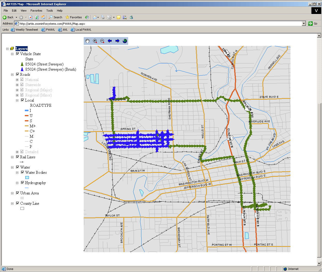
GIS Functionality
- Industry standard ESRI shape files
- GIS Toolkit allows for standard spatial queries
- Change legend symbology on-the-fly
- User data served by the Web Mapping Services (WMS)
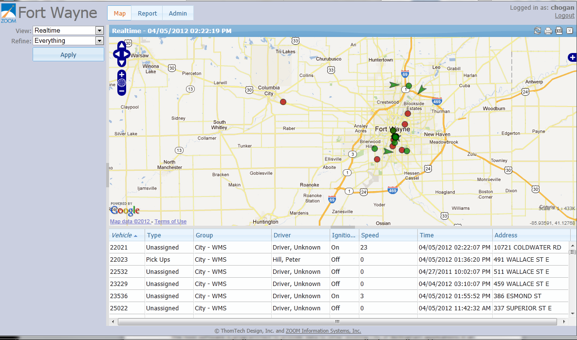
Real-Time and Historic Web Tracking
- Simple Web Mapping Functionality such as Zoom In / Zoom Out / Pan / Zoom to Full / Refresh
- Customized Display and Symbolization Options such as; show vehicles on map using symbology o Symbolize by speed, stops, friction, .etc
- On/Off Auto Refresh
- Re-sizable map
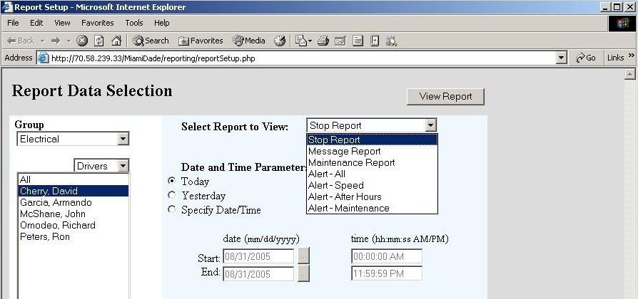
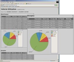
Real-Time and Historic Quick Report accompany Map View
- Web based reporting of vehicle records
- Hyperlink “Zoom-To” tool allows user to zoom-in on selected record between report and map
- Customize which fields are visible
- Customized sorting of data in Quick Report
Custom Tabular Reports
- Stop reports
- Vehicle maintenance reports
- Message reports
- Custom alerts (Speed, After Hours, Maintenance, .etc)
Query Tools
- Customized queries for mapping and reports by:
- Date/Time
- Driver
- Vehicle Number
- Department
- Subset of driver from 1 to ~ Inputs
Two Way Real-Time Messaging
- Customize message sent to vehicle
- Customize vehicle response
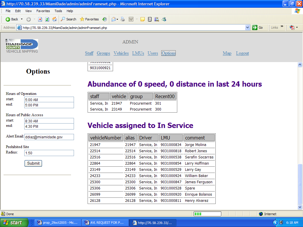
Administrative Tool
- Add Drivers
- Add Vehicles
- Add Departments
- Add Groups
- Add Users and administer viewing privileges
- Customize inputs such as hours of operation or public access times
Animated Playback for Historic Data
- Animate vehicles routes
- Use query tools to specify start and end time for playback
- See Breadcrumb trail and connect with lines
- Fast forward, reverse, go to beginning, and go to end playback features
How this product is different from competitor products?
- We try to specialize in monitoring third party equipment such as plow status, street sweeper brush speed, Vacuum truck jetter power take off status, etc.
- These specialized interfaces tend to prevent the general tracking-only competitors from bidding on the more complicated third party equipment.